Sunday, February 22, 2015

Grandeur Peak, West Approach 4.5 miles round trip,( moderate difficulty)

I made this hike on a snowy Saturday. I was very glad I had my trekking poles and chains on my boots.  This is not a difficult hike, but is very steep, and it feels great to power up to the top and exercise your leg muscles!  The trailhead starts and the North end of Wasatch Boulevard which you can access from the top of 3300 South.  Gps coordinates are: N 40* 42.453' W 111* 47.748.'
     The trail begins at the Northeast corner of the parking lot, heads East then South. At about 1/3 mile, you can choose which trail you want to use. The main trail goes steeply uphill just past the gulch.  If you go into the gulch, you can take one of several trails that allow you to hike along the North ridge where you can look down into Parley's Canyon.  This trail will eventually join the main trail to the summit.  (The coordinates to this junction are: N 40*42.460' W111* 46.508')  There was only about 3" of snow for most of the trail, but once I reached the ridge to the summit, the snow was several feet deep, but the view was fantastic and well worth the hike. ( GPS coordinates of the summit are: N40* 42.425' W 111* 45.585') I went up the North ridge and came down the Main trail, which added a little to the distance. I was the only one on the North ridge and it was fun to watch other hikers ascend the main trail to my right.  Several years ago I was making this climb in the spring of a year where there was quite a bit more snow. I had been following some deer tracks, and just past the point where the two trails meet, there was a bunch of deer fur and some blood, then no more deer tracks, but there were some cougar tracks!  I could see in the snow where the cougar had lain on it's haunches waiting for the deer, then springing for it!
     I did not expect to find any geocaches on this trip due to the snow, but there are several, and I was able to find two of them in spite of the snow: One is called, Utah Jean is My Hero 2:    Gps coordinates are: http://www.geocaching.com/geocache/GC1Y72T_utah-jean-is-my-hero-2?guid=33867f6d-1aba-410a-a88d-aac05c4d7612   The other is called EAGLE 11.  The coordinates are:
http://www.geocaching.com/geocache/GC3FVG5_eagle-11?guid=20eb42c5-7368-45c2-9fda-658b6ac26ef3

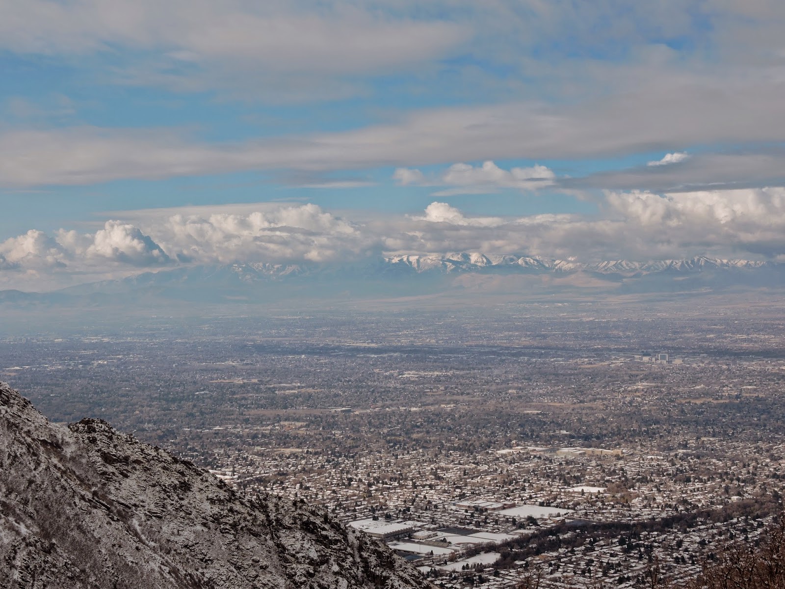
View near the junction of North and Main trails.

View on the way down.

I could actually hear what must have been Skyline High school
Marching Band from way up here!

View of Mount Olympus from the summit.

Tuesday, February 10, 2015

Donut Falls Snowshoe update (3.6 miles easy)

I have done other posts on this hike, but this one gives some details to help you get to Donut Falls without following the wrong trail in the snow.  After driving 8.8 miles up Big Cottonwood Canyon, you park in the parking area on the right (South) side of the road, go around the locked gate and head up the road.  At 1/2 mile, stay on Cardiff Fork Road continuing straight on the unplowed snow rather than going to the right.  At .82 miles you will arrive at the usual summer trailhead where you will see an outhouse. (It is locked, in case you are wondering! The one where you parked is open.)  At one mile you will see a wooden sign with orange spray paint  that says "trail" with an arrow pointing to the right.  Take this well-defined trail in front of the sign.  If you do not turn right, but go straight at this point, that will work, but is not as fun and scenic, although it is slightly shorter.  At mile 1.3 you will cross a small bridge, and a few hundred feet past the bridge you will turn left at a T with another wooden sign pointing to the left. (On your way back to your vehicle, if you miss the turnoff to the wooden bridge, you will be ok, but again, the trail over the bridge is more fun and scenic.)   At  mile 1.6 you will come to a drop off that can be quite difficult to get down safely in snowshoes. There is no need go down this way.  Instead, backtrack 50 feet or so, and you will see a much easier trail through the willows and can cross the stream easily on snowshoes.  At the Falls, you will see a danger sign. In years of lots of snow, it is easy to get up to and enter the cave on snowshoes.  If you want to enter the cave, an ice axe will be very useful.   When you get back to your vehicle, you will have hiked about 3.6 miles.   On this trip, I saw no wildlife, but I did see some fairly fresh moose tracks!
Near the Trailhead


Turn right AFTER this sign!

Stay straight on Cardiff Fork Road.

View on the way up to Donut Falls

View heading back to the trailhead.

This is why I love early morning hikes!

Turn left at this 'T.'